Hurricane Maria, which continued to strengthen Sunday, maintained a west-northwest track Sunday night toward the already storm-battered Leeward Islands.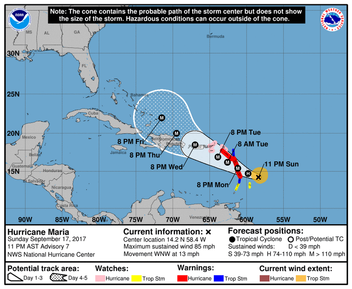
As of 11 p.m., Maria, which became a Category 1 hurricane Sunday afternoon, was located 210 miles east-southeast of Dominica with sustained winds of 85 mph.
Forecasters expect Maria, which was moving west-northwest at 13 mph, to hit the Leeward Islands Monday and become a major hurricane by the time it nears Puerto Rico Tuesday.
A “burst of convection” occurred in the storm’s center Sunday afternoon, with an open eyewall forming in the the storm’s core, National Hurricane Center forecasters said. Because the storm is compact, it could quickly intensify as it moves over warm ocean waters and faces weak wind shear, they said.
Maria should become a major storm over the next two days, which could cause wind speeds to vary slightly if it undergoes eyewall replacements, which big storms are prone to do.
Hurricane advisories continue to extend across Caribbean islands battered by Irma as the storm approaches. Forecast models generally agree on a track that takes Maria near Guadalupe and the northern islands of the Lesser Antilles on Monday and near Puerto Rico on Tuesday as a major hurricane.
It’s too soon to tell Maria’s impacts to Florida or the U.S. coast. Early models show the storm moving toward Florida and up the East Coast, but forecasts so far in advance can be hundreds of miles off.
By Sunday night, tropical storm force winds extended 105 miles from Maria’s center. Within three days, forecasters say sustained winds could reach 125 mph.